Strong to Severe Storms Target Illinois Friday Evening With Tornadoes Possible Before a Destructive Squall Line Sweeps Through Overnight
ILLINOIS — Friday April 17, 2026 brings a multi-phase severe weather threat to Illinois with strong to severe thunderstorms likely from late afternoon through midnight. The day starts dry but storms firing after 2 to 3 PM across Iowa and northwest Illinois will quickly develop tornado potential before organizing into a destructive squall line pushing east through the night.
How Friday Unfolds Across Illinois
Phase 1 — Afternoon (2 PM to 6 PM) Storms fire after 2 to 3 PM near the Mississippi River and northwest Illinois. Early storms carry tornado potential Friday afternoon and early evening before the atmosphere becomes dominated by the squall line.
Phase 2 — Evening Into Overnight (6 PM to Midnight) Storms grow upscale quickly into a big squall line sweeping east across northern and central Illinois. The main threat shifts to damaging winds though hail and an embedded tornado cannot be ruled out. The squall line moves through 6 PM to midnight before ending Saturday morning.
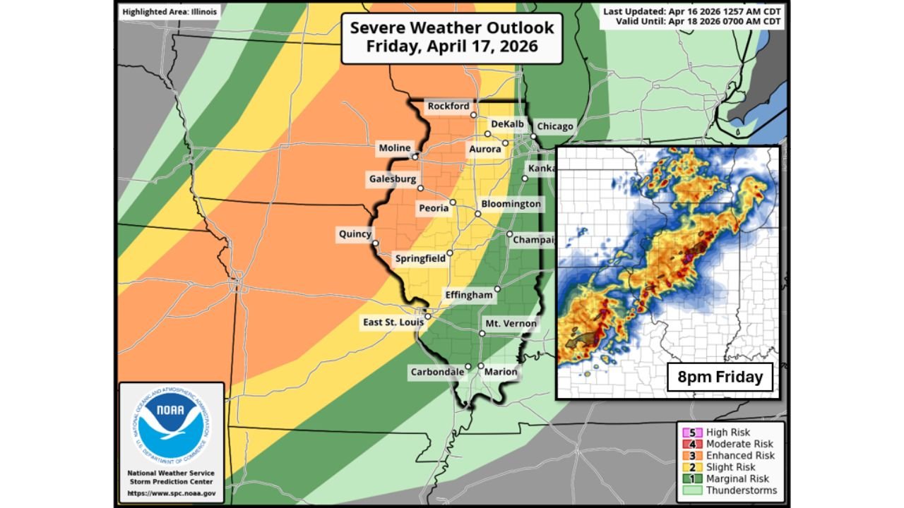
Risk Zones Across Illinois Friday
| Risk Level | Illinois Cities |
|---|---|
| Enhanced Risk | Moline, Galesburg, Peoria, Quincy, Springfield, Aurora, Bloomington |
| Slight Risk | Rockford, DeKalb, Chicago, Kankakee, Champaign, Effingham, East St. Louis |
| Marginal Risk | Mt. Vernon, Carbondale, Marion |
Additional Concerns
Heavy rain alongside the squall line may cause flooding, particularly in areas already dealing with high water levels. Temperatures will fall sharply overnight as colder air moves in for the weekend behind the front.
Have alerts active from 2 PM Friday through Saturday morning and know your shelter before storms arrive.
Stay with CabarrusWeekly.com for live Friday severe weather coverage across Illinois.