Texas to Illinois Severe Storm Corridor Expands as NOAA Introduces New Tornado Intensity Scale in March 6 Outlook
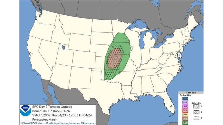
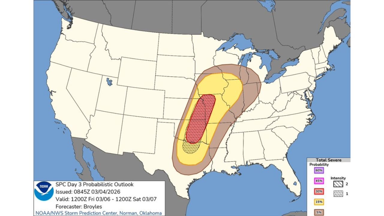
UNITED STATES — A broad corridor of severe weather is taking shape from Texas through Arkansas, Missouri, Illinois and into the southern Great Lakes, as NOAA’s Storm Prediction Center (SPC) highlights an organized storm threat for Friday, March 6.
At the same time, the SPC is rolling out an important update to how it communicates storm intensity — a change that could affect how tornado risks are interpreted nationwide.
Severe Storm Risk Stretching From Texas to the Midwest
The Day 3 outlook shows a concentrated severe weather zone extending northeast from central and eastern Texas, through Arkansas and Missouri, into Illinois and parts of the Midwest.
Within that broader area:
- A central corridor carries higher severe probabilities.
- Surrounding regions remain under lower but notable risk levels.
- The threat zone arcs from the Southern Plains into the Mid-Mississippi Valley and toward the southern Great Lakes.
This pattern suggests a strong storm system capable of producing organized severe thunderstorms along a southwest-to-northeast axis.
Tornado, Wind and Hail Threats Possible
The highlighted corridor indicates potential for:
- Tornadoes
- Damaging straight-line winds
- Large hail
The elongated shape of the risk area often signals a dynamic storm system with strong upper-level support and wind shear favorable for rotating storms.
While exact placement may still shift, the current setup places millions of residents from Texas to Illinois within the potential severe zone.
SPC Introduces “Conditional Intensity Groups”
Alongside this outlook, the SPC is introducing new “Conditional Intensity Groups” to better communicate how intense severe hazards could become.
Importantly, the traditional five-level categorical risk system — Marginal (1), Slight (2), Enhanced (3), Moderate (4), and High (5) — remains unchanged.
What’s new is how intensity is displayed on individual hazard graphics.
How the New Intensity Levels Work
For tornadoes and wind, three intensity tiers may now appear:
- Intensity Level 1: Maximum expected EF2
- Intensity Level 2: Maximum expected EF3
- Intensity Level 3: Maximum expected EF4
For hail, two intensity levels may be used.
These categories are conditional, meaning they answer the question:
“If a tornado occurs, how intense could it become?”
This change allows forecasters to highlight potentially significant tornado strength even if the overall probability area does not reach traditional thresholds.
Why This Matters
Previously, highlighting significant tornado potential required at least a 10% probability area. Under the new methodology, intensity forecasts are more closely tied to:
- Storm environment
- Wind shear
- Instability
- Expected storm mode
This provides more nuance in communicating risk severity.
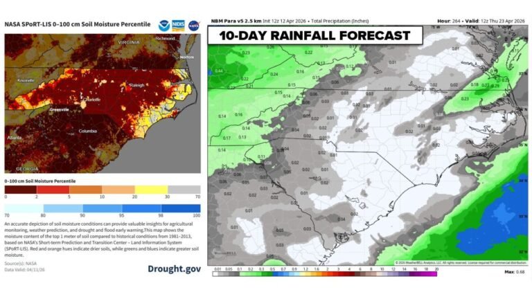
What About North Carolina?
The March 6 outlook does not include North Carolina in the primary severe corridor. However, large-scale systems moving through the Plains and Midwest often influence downstream weather patterns in the Southeast.
Forecasters note that the next organized severe weather chance for parts of the Deep South could emerge around the middle of next week, depending on how the broader pattern evolves.
For now, the most significant focus remains from Texas through the Mid-Mississippi Valley and into Illinois and the southern Great Lakes.
CabarrusWeekly.com will continue monitoring national severe weather developments and provide updates if pattern shifts begin impacting North Carolina.