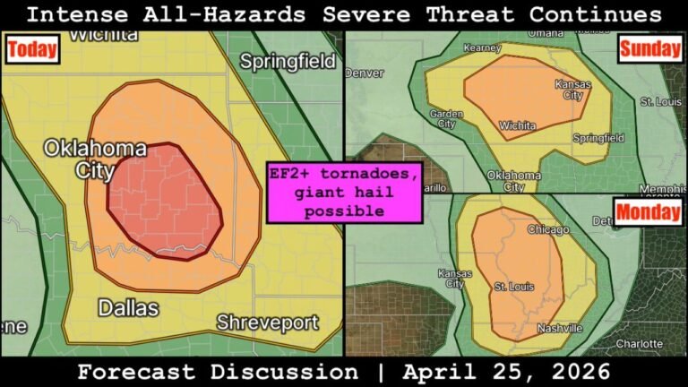
Iowa, Missouri and Oklahoma Face Dual Tornado Targets Today as Supercells Threaten Large Hail, Damaging Winds and Possible Tornadoes
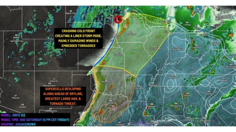
IOWA — A dynamic and potentially dangerous severe weather setup is unfolding today across the Plains into the Midwest, with two distinct tornado target zones emerging from central Iowa into northern Missouri and down into central and eastern Oklahoma.
A strong upper-level disturbance is lifting northeast, helping to trigger thunderstorms this afternoon and evening, with conditions supportive of supercells capable of producing large hail, damaging winds, and isolated tornadoes.
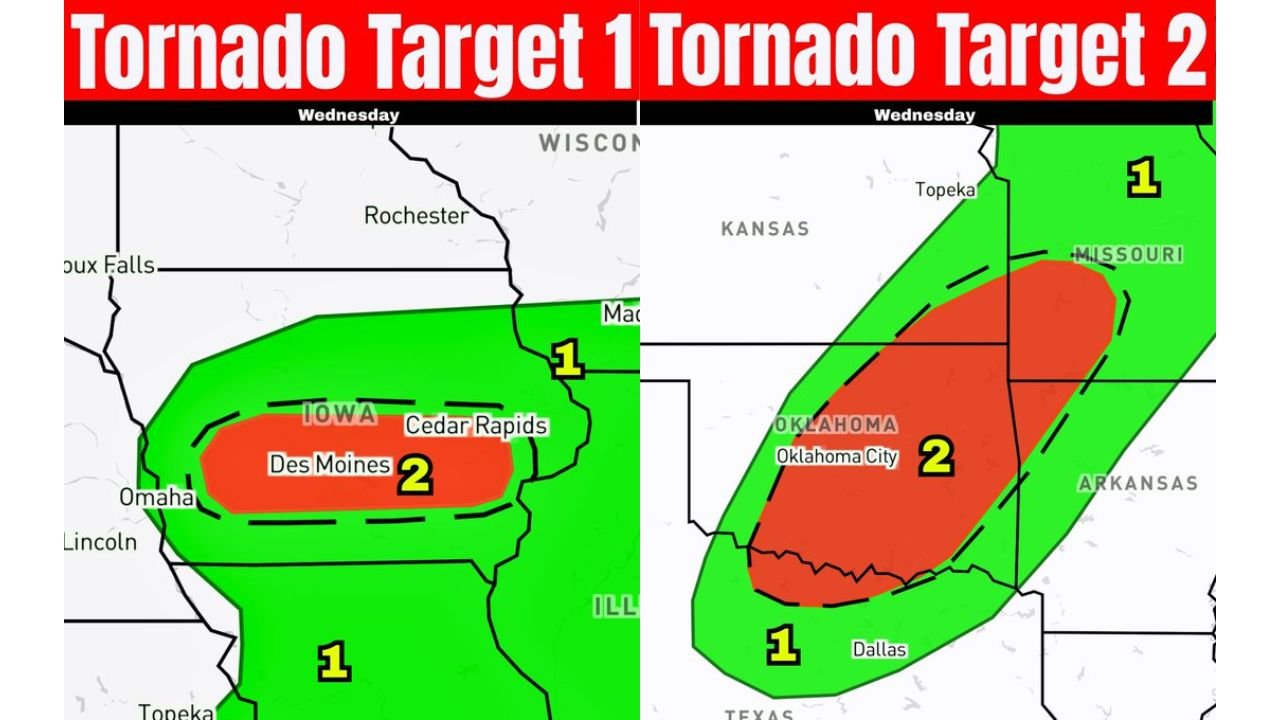
Primary Tornado Target Setting Up Over Iowa Into Northern Missouri
The most concerning setup is developing across central Iowa, including areas near Des Moines and Cedar Rapids, extending into northern Missouri.
This region is marked as a Level 2 tornado target zone, where:
- Storms are expected to develop by late afternoon
- A surface low will enhance storm organization
- Strong mid-level winds will support splitting supercells
- Backed surface winds may increase low-level rotation potential
The I-80 corridor in Iowa stands out as a key area where conditions could align for a stronger tornado risk, especially if instability increases through the afternoon.
Large hail is expected to be a major threat early on, with storms potentially producing very large hailstones before transitioning into more organized structures.
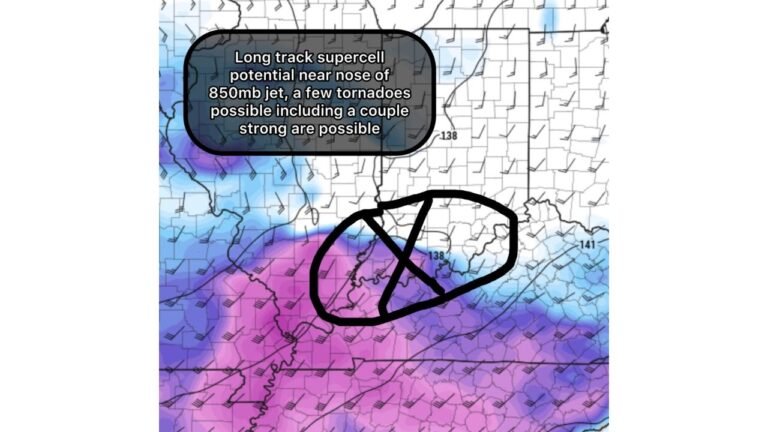
Secondary Severe Target Across Oklahoma With Discrete Supercells
A second significant severe weather zone is taking shape across central and western Oklahoma, including areas near Oklahoma City.
Here, storms are expected to initiate along the dryline by mid-afternoon, with the following threats:
- Discrete supercells early, capable of producing large hail
- Transition into clustered or linear storms by evening
- Increasing risk of damaging winds and isolated tornadoes
This region is also categorized as a Level 2 tornado target, signaling a notable but more conditional tornado threat compared to Iowa.
Storm Evolution Expected Through Evening
Both target areas share a similar evolution pattern:
- Afternoon: Storm initiation with discrete supercells
- Early Evening: Peak severe threat with hail and tornado potential
- Late Evening: Transition into lines, increasing wind damage risk
As storms grow upscale, the focus may shift from tornadoes to widespread damaging wind gusts, especially across Oklahoma and parts of Missouri.
Why This Setup Is Concerning
This is a classic spring severe weather pattern featuring:
- Strong upper-level support
- Favorable wind shear profiles
- Multiple storm initiation zones
- Increasing instability through the day
The presence of bi-modal target areas means multiple regions could see significant severe weather at the same time, increasing overall impact potential.
Areas to Watch Closely Today
The highest concern zones include:
- Des Moines, Cedar Rapids, and central Iowa
- Northern Missouri
- Oklahoma City and surrounding areas in central Oklahoma
- Parts of southern Kansas and northern Arkansas
Residents in these areas should be prepared for rapidly changing weather conditions through the afternoon and evening hours.
Bottom Line
Two separate but dangerous severe weather zones are expected today across the Midwest and Southern Plains, with central Iowa/northern Missouri and Oklahoma both facing supercell development capable of large hail, damaging winds, and a few tornadoes.
With storms expected to intensify quickly later today, staying weather-aware will be critical as this volatile setup unfolds.