Florida Faces Rotating Supercell With Hail, Tornadic Waterspouts and Significant Tornado Possible Near Tampa, Clearwater, Hudson and Saint Petersburg Between 1:00 PM and 2:30 PM Tuesday May 12
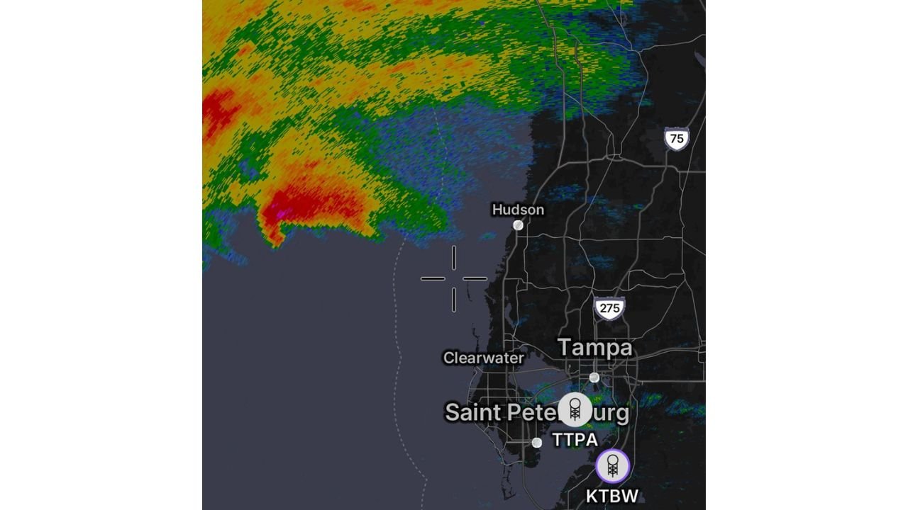
TAMPA, Florida — A dangerous rotating supercell complete with hail and a series of strong tornadic waterspouts is moving southeast toward the Florida coast and could reach land between 1:00 PM and 2:30 PM this afternoon, Tuesday, May 12, 2026.
If this storm holds together as it crosses the coastline near Tampa, Clearwater, Hudson and Saint Petersburg, an isolated significant tornado is possible. Residents in these areas must take shelter immediately.
What Is Moving Toward the Coast Right Now
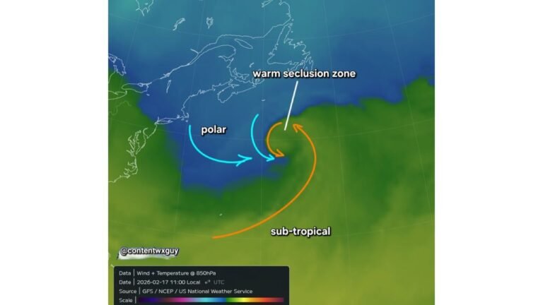
A rotating supercell is the most dangerous type of individual thunderstorm and is capable of producing long-track tornadoes, very large hail and destructive winds:
- This particular supercell is already producing hail and a series of strong tornadic waterspouts over the water as it tracks southeast toward the Florida coastline north of Tampa.
- Tornadic waterspouts are rotating columns of air connected to a thunderstorm over water. When a tornadic waterspout crosses onto land it immediately becomes a tornado capable of destroying structures and injuring or killing anyone in its path.
- The storm is forecast to reach the Florida coast between 1:00 PM and 2:30 PM this afternoon, giving residents north of Tampa and near Hudson, Clearwater and Saint Petersburg a very narrow window to get to shelter right now.
Significant Tornado Threat if Storm Holds Together
The most critical concern with this storm is what happens the moment it crosses from water onto land:
- If this rotating supercell holds together as it crosses the Florida coastline, an isolated significant tornado is possible across areas near and north of Tampa including Hudson, Clearwater and Saint Petersburg.
- A significant tornado means a storm rated EF-2 or higher, capable of destroying well-built homes, snapping large trees and producing life-threatening conditions for anyone not in a sturdy shelter.
- Do not wait to see or hear this storm before taking action. By the time a tornado is visible from the Tampa area coastline, it may already be too late to reach shelter safely.
Who Needs to Act Right Now
Anyone currently in or near the following locations must take shelter immediately and not wait for a warning to be issued:
- Hudson, Florida sits north of Tampa and directly in the projected path of this supercell as it crosses the coastline between 1:00 PM and 2:30 PM.
- Clearwater, Florida and Saint Petersburg, Florida are within the threat zone and should treat this as an imminent tornado threat given the rotating nature of the storm already producing waterspouts offshore.
- Tampa, Florida residents near and north of the city should also shelter immediately as the storm tracks southeast and could affect the broader metro area during the 1:00 PM to 2:30 PM window.
Where to Shelter Right Now
Every second counts with a tornadic supercell approaching the coastline this quickly:
- Move to an interior room on the lowest floor of a sturdy building away from all windows immediately. A bathroom, closet or hallway on the lowest floor with no windows is your safest option.
- If you are in a mobile or manufactured home near Hudson, Clearwater, Saint Petersburg or Tampa, do not stay inside. Get to the nearest sturdy permanent structure immediately as mobile homes offer no protection from a significant tornado.
- Do not attempt to drive away from this storm. The supercell is moving southeast and driving perpendicular to its path on coastal Florida roads could put you directly in its track.
Cabarrusweekly.com will continue tracking this rotating supercell and significant tornado threat across Florida near Tampa, Clearwater, Hudson and Saint Petersburg and will provide updates as storm movement, tornado warnings and coastal landfall timing between 1:00 PM and 2:30 PM develop.