Monday Severe Risk Pulls Back to Northwest Alabama as Storms Shift to Late Monday Night and Tuesday
NORTHWEST ALABAMA — The severe weather outlook for Monday April 27 across Alabama has been scaled back significantly, with the Storm Prediction Center pulling the risk area back to a smaller portion of Northwest Alabama only — as the main storm energy now appears likely to stay west of Alabama through most of Monday, with the more impactful weather arriving late Monday night into Tuesday.
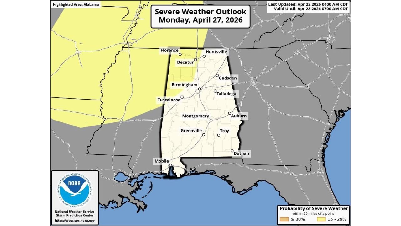
Severe Risk Now Limited to Northwest Alabama Corner
The updated SPC severe weather outlook valid Monday April 27 shows the 15 to 29 percent severe probability zone now covering only the northwestern corner of Alabama, with the risk footprint clipping Florence, Decatur, and Huntsville along the northern edge. The vast majority of Alabama — including Birmingham, Tuscaloosa, Montgomery, Gadsden, Talladega, Auburn, Troy, Dothan, and Mobile — now sits outside the defined severe weather risk area for Monday.
This represents a notable pullback from earlier outlooks that had placed a much larger portion of North and Central Alabama within the risk zone.
Main Rain and Storms Staying West of Alabama Through Monday
Long-range guidance is keeping most of Monday’s rain and storm activity west of Alabama, suggesting the bulk of the state will see a mostly dry Monday before conditions deteriorate later. The storm system is expected to arrive late Monday night, with the more active and potentially severe weather pushing into Alabama on Tuesday.
Whether Tuesday carries a formal severe weather risk for Alabama remains to be determined as forecast models continue to refine the timing and intensity of the approaching system.
Unstable Airmass Dominates the Deep South All Week
Even with Monday’s risk area trimmed back, the broader picture for Alabama and the Deep South next week remains unsettled and potentially active. An unstable airmass is expected to be in place across the Deep South for most of the week, supporting multiple days with shower and storm chances as disturbances move through the region. Pinning down specific timing and severe potential for each day remains challenging at this range.
| Day | Alabama Severe Risk | Expected Conditions |
|---|---|---|
| Monday Apr 27 | 15-29% — NW Alabama only | Mostly dry, storms arrive late night |
| Tuesday Apr 28 | To be determined | Storms possible — severity unclear |
| Rest of week | Multiple unsettled days | Showers and storms likely |
Stay with CabarrusWeekly.com for live severe weather outlook updates across Alabama through Tuesday April 28 and beyond.