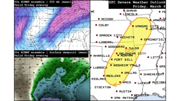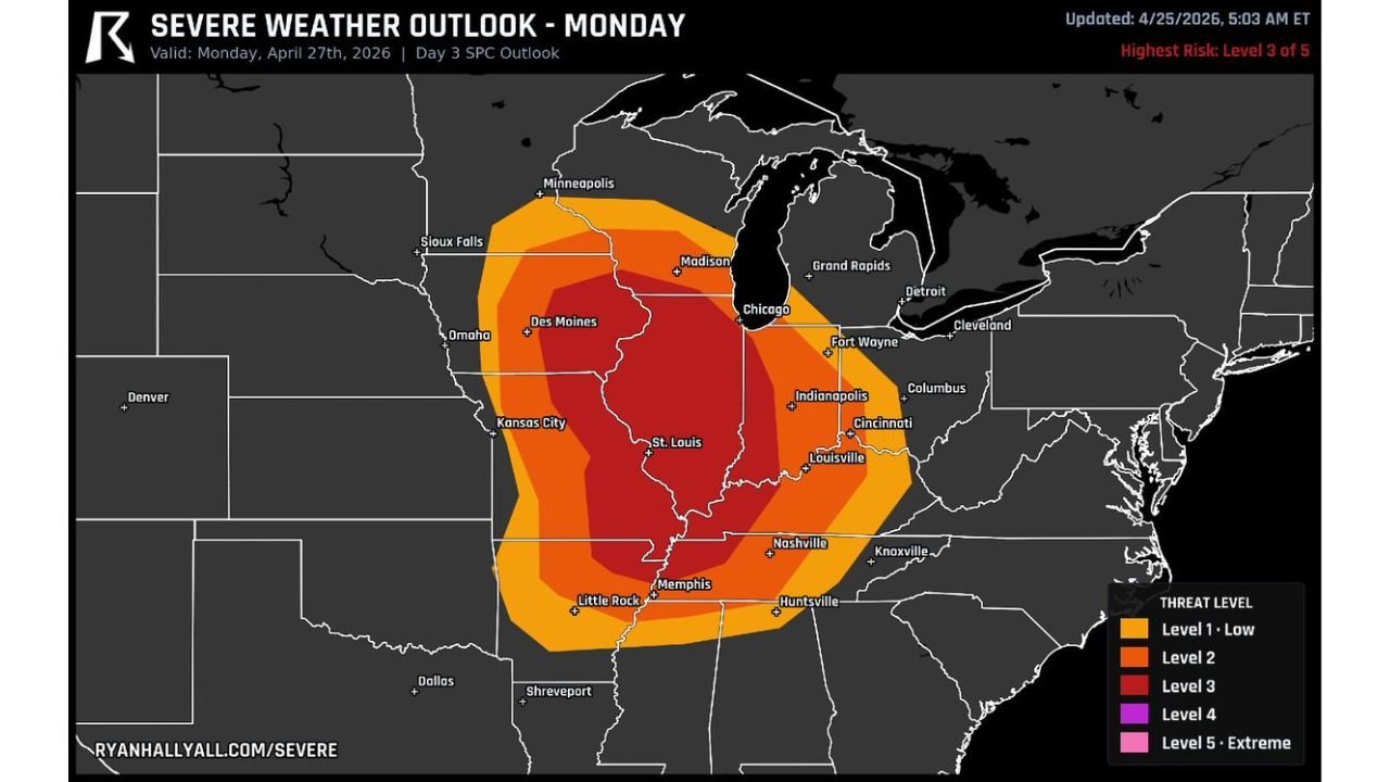
Chicago, St. Louis and Memphis All Inside Monday’s Level 3 Severe Risk as Iowa and Illinois Face the Strongest Long-Track Tornado Window
ST. LOUIS, Missouri — Monday’s severe weather outlook has locked in at Level 3 of 5 across a massive corridor stretching from Iowa and Illinois south through Missouri, Tennessee, and into Arkansas and Mississippi. The dark red Level 3 core on Ryan Hall’s severe weather map covers an extraordinary lineup of major cities simultaneously: Chicago, Madison, Des Moines, St. Louis, Indianapolis, Louisville, Nashville, Memphis, and Little Rock are all inside or immediately adjacent to the highest risk zone.
The afternoon starts with the most dangerous scenario — individual rotating supercells forming early across Iowa, Illinois, and Missouri that carry the highest risk of producing strong, long-track tornadoes. As evening arrives, those storms are expected to merge into a larger line or cluster moving southeast, shifting the primary threat toward widespread damaging winds across Tennessee, Kentucky, and beyond.
The Two-Phase Threat and Why Phase One Is the Most Dangerous
The timing distinction matters enormously for understanding Monday’s risk. Two completely different severe weather scenarios unfold in sequence, and which one affects your city depends heavily on what time storms arrive.
During the early afternoon, discrete rotating supercells are the story. Iowa, Illinois, and Missouri see the opening phase of storm development, and individual supercells in this environment — sitting inside a Level 3 risk with a roaring jet stream overhead and deep Gulf moisture at the surface — are capable of producing strong, long-track tornadoes. A long-track tornado from a sustained supercell is one of the most destructive weather events that can occur over populated terrain. It does not hop and skip like a brief spin-up — it stays on the ground for miles, sometimes tens of miles, grinding through everything in its path.
Iowa and Illinois are specifically called out as the highest risk for this long-track tornado scenario. Des Moines, Springfield Illinois, and communities across central Illinois need to treat early Monday afternoon as the most dangerous window of the event.
As evening progresses, storms merge. The tornado risk does not disappear when storms go linear — QLCS systems can produce brief spin-up tornadoes — but the primary hazard becomes organized squall line winds capable of producing widespread damage across Tennessee, Kentucky, Indiana, and Ohio as the system tracks southeast through the night.
Every Major City on This Map Needs a Plan Before Monday Morning
The geographic scope of Monday’s Level 3 zone is striking. Reading the dark red corridor from north to south:
Wisconsin — Madison sits inside the Level 3 zone, an unusually northern extent for a significant tornado risk in late April.
Iowa — Des Moines and much of central and southern Iowa inside the core risk with the highest long-track tornado potential of the entire event.
Illinois — Chicago is inside the Level 3 zone. Chicago being in a Level 3 severe weather outlook with a long-track tornado threat is not a routine occurrence. The entire state from Chicago south through Springfield is inside the core risk corridor.
Indiana — Fort Wayne, Indianapolis, and Cincinnati border area all inside the Level 3 zone.
Missouri — St. Louis and Kansas City both inside the core threat, with St. Louis sitting particularly exposed given its position in the middle of the warm sector.
Kentucky — Louisville, Lexington, and Paducah all inside the Level 3 or its immediate outer ring.
Tennessee — Nashville, Memphis, and Huntsville all inside the core risk zone. Nashville specifically sits at the southern edge of the Level 3 where the merging storm line arrives with damaging wind potential during the evening and overnight.
Arkansas — Little Rock inside the broader threat area.
Ohio — Columbus, Cleveland, and Cincinnati on the eastern fringe of the Level 3 zone.
What Des Moines and Chicago Need to Understand About the Early Window
Des Moines and central Iowa face the tornado scenario that most people associate with Kansas or Oklahoma — discrete rotating supercells with the atmospheric fuel and wind shear to sustain long-track tornadoes for 20, 30, or even 50 miles. That scenario is being explicitly flagged for Iowa on Monday afternoon.
Chicago inside a Level 3 severe weather outlook deserves particular attention because of the population density involved. The Chicago metro area has over 9 million people. A long-track tornado from a sustained supercell tracking northeast across the metro’s suburban sprawl would be a mass casualty event of historic proportions. The probability of that specific scenario is not the highest on the map — but it is not zero, and the consequence if it occurs demands preparation that matches the potential outcome.
Illinois communities between Springfield and Chicago sit in the zone where early afternoon supercell development is most likely and where the terrain provides no natural barriers. Storms can travel from Missouri into Illinois and across the state without any significant terrain impediment.
After Sunset — The Line Hits Tennessee and Kentucky
As the evening progresses and individual supercells merge into a larger line or cluster, the threat axis shifts southeast. Nashville, Louisville, Evansville, and Lexington face the organized squall line scenario during the evening and overnight hours. Damaging straight-line winds from a bowing squall line with the jet stream overhead can produce gusts exceeding 75 mph across wide areas, taking down trees, power lines, and causing structural damage to poorly constructed or older buildings.
Monday overnight becomes the most dangerous period for Tennessee and Kentucky — storms arriving after dark when most residents are asleep, warning response times are slower, and tornado sirens may not wake people in time even when warnings are issued with reasonable lead time.
Every Household Between Des Moines and Nashville Has Work to Do This Weekend
Charge phones and weather radios today and Sunday. Identify the interior shelter location in your home or workplace before Monday morning. Know the difference between a Watch and a Warning — a Watch means conditions are favorable and you should be ready, a Warning means a storm is imminent and you should already be moving to shelter.
For Iowa and Illinois specifically, have the shelter plan in place before noon Monday. For Tennessee and Kentucky, have it in place before dinner. The storm arrives in sequence — late afternoon for the north, evening and overnight for the south.
CabarrusWeekly.com will track Monday’s Level 3 outbreak across the Mississippi and Ohio Valleys in real time and provide updates through the day and overnight as the system progresses southeast.