Tonight, Baltimore and Areas North and West of I-95 Could Drop Into the 30s With Frost Possible by Tuesday Morning — the Latest Freeze Date on Record Since 1966
BALTIMORE, MARYLAND — A remarkably cold night is setting up for Baltimore and areas north and west of I-95, with temperatures forecast to drop into the 30s overnight if skies clear. Frost is possible in some spots by Tuesday morning, May 12, 2026 — a striking reminder that on May 11, 1966, Baltimore recorded a morning low of 32 degrees, the latest freezing temperature ever recorded in the city’s history.
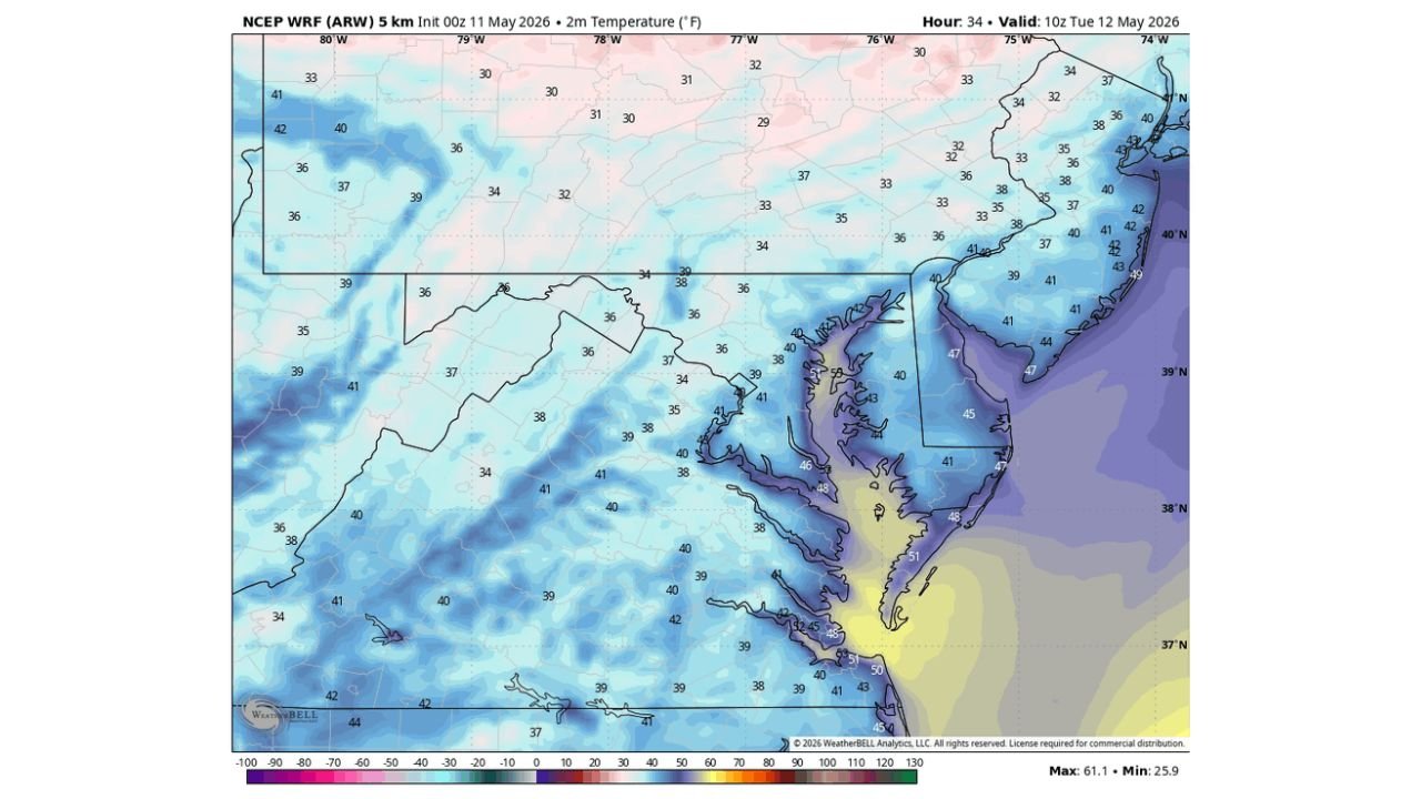
How Cold Could It Get Tonight
Temperature forecast data valid at 10z Tuesday May 12, 2026 shows a wide area of dangerously cold readings across the mid-Atlantic region:
- Areas north and west of I-95 — dropping into the 30s overnight
- Some interior locations — readings as low as the upper 20s to low 30s across Pennsylvania and surrounding areas
- Baltimore metro — may not hit 32 but cold enough for frost in some spots
- Coastal areas — remaining slightly warmer in the low to mid 40s
Frost Risk Is Real for Some Spots
While a hard freeze at 32 degrees may not materialize everywhere, the combination of clearing skies and cold air drainage means frost formation is possible across elevated and inland areas north and west of the I-95 corridor. Gardeners and anyone with sensitive plants outdoors should take precautions tonight.
A Historic Cold Reference
The last time Baltimore recorded a temperature this late in the season at or below freezing was May 11, 1966 — 60 years ago to the day. Tonight has the potential to approach that benchmark.
Stay with CabarrusWeekly.com for updates on tonight’s frost threat across the Baltimore region and mid-Atlantic.