Tuesday Night, Chicago, Peoria, Indianapolis, and Milwaukee Face a Line of Rain and Storms With 40 to 50 MPH Wind Gusts Possible Across Northern Illinois and Northern Indiana
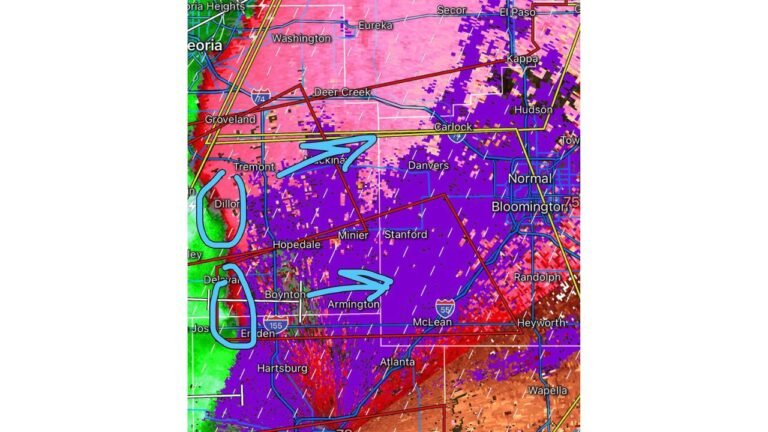
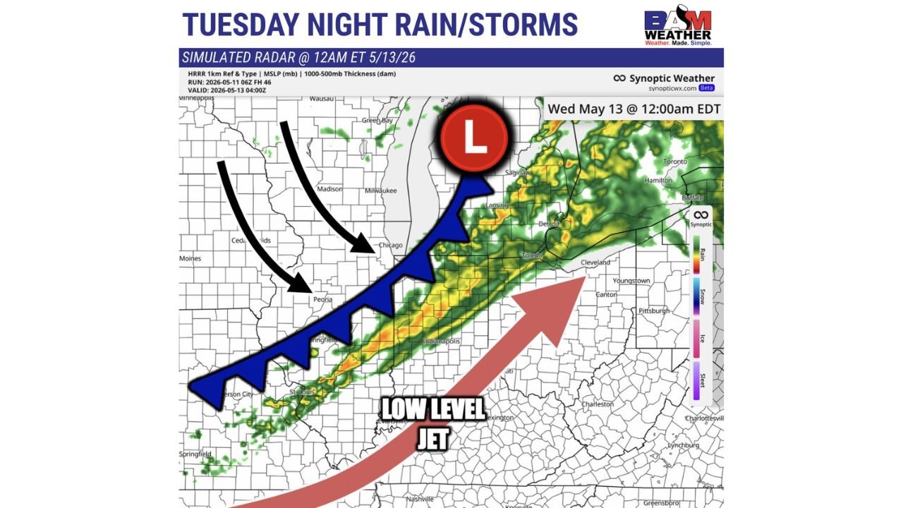
NORTHERN ILLINOIS AND NORTHERN INDIANA — A line of rain and storms is forecast to push across the region late Tuesday evening into Tuesday night, May 12-13, 2026, bringing wind gusts of 40 to 50 MPH or higher mainly across northern Illinois and northern Indiana. Simulated radar valid at 12:00 AM EDT Wednesday May 13 shows the storm line cutting through the heart of the region.
Storm Line Targets the Chicago to Indianapolis Corridor
The simulated radar shows a well-defined line of precipitation stretching from the St. Louis and Springfield area northeast through Peoria, Chicago, and Milwaukee, with storm activity extending east toward Indianapolis, Toledo, and Detroit. A low-pressure system is positioned near the Green Bay and Saginaw area by midnight, driving the cold front southward.
A low-level jet is feeding moisture and energy into the system from the south, enhancing storm intensity as the line pushes through.
Hazards to Watch Tuesday Night
- Wind gusts 40 to 50 MPH or higher — primarily northern Illinois and northern Indiana
- Rain and embedded storms along the entire frontal boundary
- Strongest activity expected in the Chicago, Peoria, and Indianapolis corridor
Timing
- Arrival: Late Tuesday evening
- Peak activity: Around or after midnight into early Wednesday morning
- Areas most exposed: Northern Illinois and northern Indiana along and ahead of the cold front
Stay with CabarrusWeekly.com for live updates as this storm line pushes through the Midwest Tuesday night.