Atlantic Basin Long Range Forecast Hints at Below Normal Hurricane Activity Along Typical Storm Tracks Off Africa and the US East Coast During Peak Season July Through September 2026
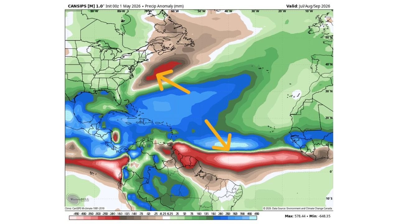
ATLANTIC BASIN — A long range precipitation anomaly forecast valid for July, August, and September 2026 — the peak of hurricane season — is showing two notable dry zones across the Atlantic Basin that could signal below normal hurricane and tropical storm activity along the most historically active storm tracks.
Two Key Dry Zones Flagged for Peak Hurricane Season
The CANSIPS precipitation anomaly forecast initialized 00Z May 1, 2026 and valid through the July-August-September 2026 window shows:
- Dry zone one — located off the US East Coast, covering a zone where tropical systems historically track northward toward the Eastern Seaboard. Below normal precipitation in this corridor suggests lower than normal tropical storm activity along this track.
- Dry zone two — positioned off the coast of Africa near the traditional hurricane development zone, where Atlantic storms typically form and organize before tracking westward. Drier than normal conditions here signal suppressed storm genesis at the source region during peak season.
What the Blue Zone Across the Main Atlantic Tells Us
A broad zone of below normal precipitation covers much of the central Atlantic Basin between the two flagged areas, reinforcing the signal for a potentially quieter than expected pattern along the main hurricane development track during the July through September peak window.
Uncertainty Remains High
Long range seasonal forecasts carry significant uncertainty this far out. This is one model’s signal for the peak of the 2026 Atlantic hurricane season and not a definitive forecast. The pattern warrants monitoring as the season approaches.
Stay with CabarrusWeekly.com for continued coverage of the 2026 Atlantic hurricane season outlook as summer approaches.