Nebraska, Iowa and South Dakota Face a Severe Weather Outbreak With Strong Tornadoes and Very Large Hail Near Omaha, Sioux Falls and Des Moines Sunday May 17
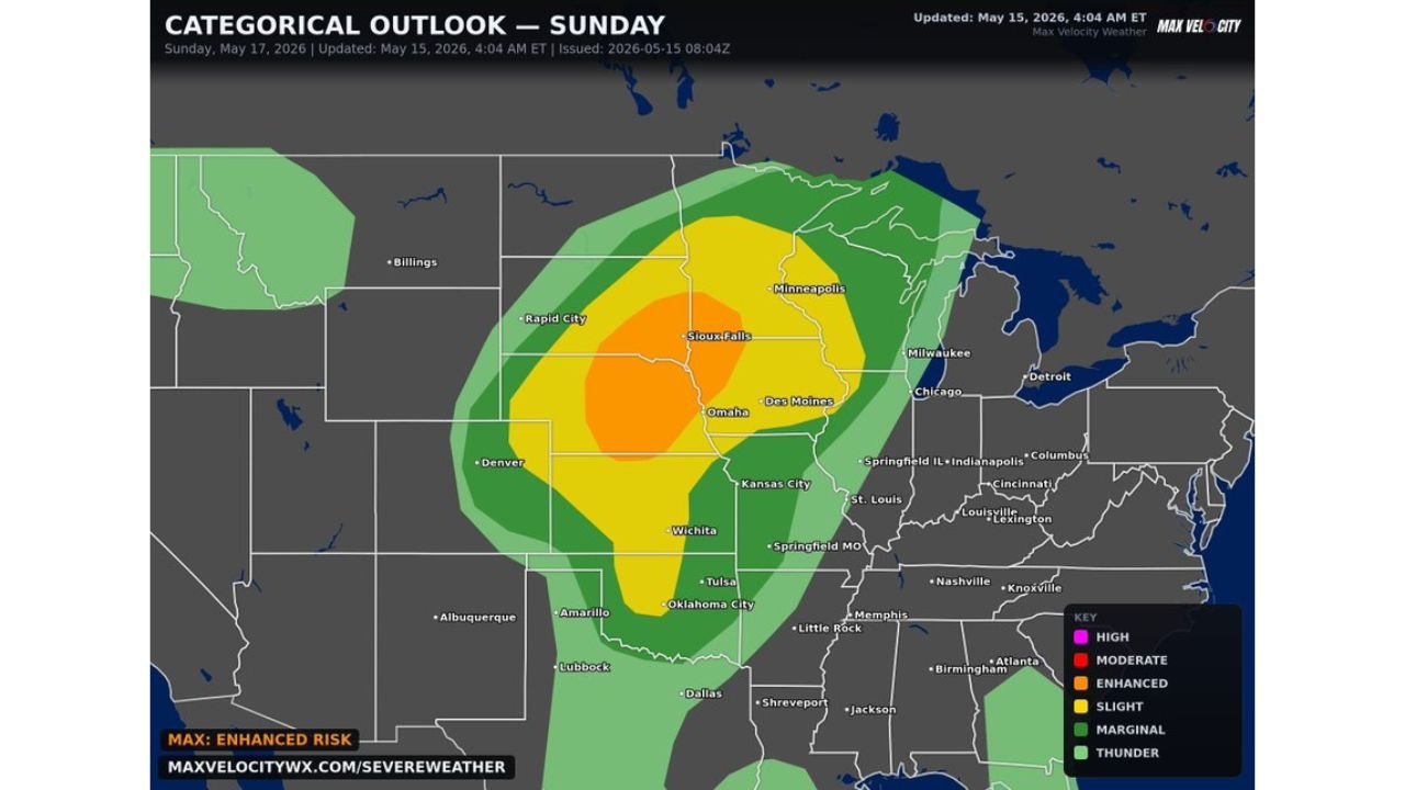
OMAHA, NEBRASKA — A severe weather outbreak is possible across the Great Plains and Midwest on Sunday May 17, 2026, with very large hail, damaging winds, and a few strong tornadoes likely. The categorical outlook updated at 4:04 AM ET on May 15, 2026 shows an Enhanced Risk centered directly over Omaha and Sioux Falls, with both discrete supercells and a line of thunderstorms expected to bring all hazards simultaneously.
Threat Zone Breakdown for Sunday
Enhanced Risk core zone:
- Omaha, Sioux Falls, and Des Moines sit directly inside the highest risk area
- Both discrete supercells and squall line activity expected in this zone
Slight Risk surrounding zone:
- Minneapolis, Kansas City, Wichita, Tulsa, and Oklahoma City inside the Slight Risk corridor
- Extends east toward Springfield IL, Indianapolis, and St. Louis
Marginal Risk outer zone:
- Reaches from Rapid City in the northwest through Chicago and Milwaukee to the northeast
- Extends south toward Dallas, Amarillo, and Lubbock
All Hazards Likely Sunday
- Strong tornadoes — a few expected with discrete supercells
- Very large hail — widespread threat across the Enhanced and Slight zones
- Damaging winds — both from supercells and the squall line
- Double threat from discrete supercells early and a line of storms later
This Is an Outbreak Level Setup
The combination of an Enhanced Risk covering Omaha and Sioux Falls, discrete supercell potential, and an organized squall line makes Sunday one of the most significant severe weather days of the 2026 spring season so far.
Stay with CabarrusWeekly.com for live updates as this Sunday severe weather outbreak develops across the Plains and Midwest.