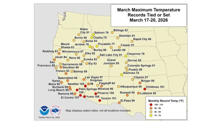
Florida’s West Coast Returns to a Classic High Pressure Pattern This Weekend With Scattered Afternoon Showers Staying Mainly South and East Friday Through Sunday May 15-17
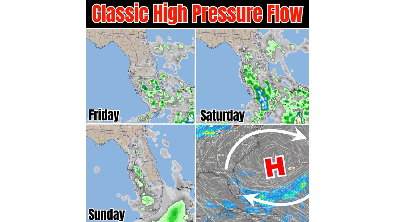
WEST COAST FLORIDA — A classic high pressure flow is locking in across the Florida Peninsula through the weekend and into next week, bringing a return to a more typical weather pattern for the west side of the state. High pressure positioned off the Atlantic Coast is pushing moisture east to west, keeping the bulk of shower activity focused on central and south Florida while the west coast stays relatively dry through Friday, Saturday, and Sunday May 15 through 17.
Day by Day Rainfall Pattern
Friday: Scattered shower activity is present across central Florida and south of the Orlando corridor, with the west coast of the peninsula seeing very little to no rainfall. Totals remain at or near zero across most of the Gulf Coast side.
Saturday: Shower coverage increases slightly across central Florida, with isolated heavier cells possible over the interior. The west coast again stays largely dry as the high pressure flow maintains its grip.
Sunday: Activity becomes more focused across southern Florida, with the remainder of the peninsula seeing minimal rainfall. The pattern holds into next week.
What Is Driving This Pattern
A strong 1024 MB high pressure system positioned off the Southeast Atlantic Coast is circulating moisture in a classic east to west flow across the Florida Peninsula. This setup historically keeps afternoon sea breeze showers focused on the interior and east coast while suppressing activity on the Gulf side.
Stay with CabarrusWeekly.com for the latest updates as this classic Florida high pressure pattern holds through the weekend.