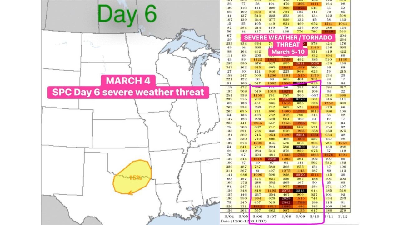
Day 6 Severe Weather Risk Expands Across North Texas and Oklahoma for March 4 as SPC Flags 15% Threat Ahead of Active Early-March Pattern
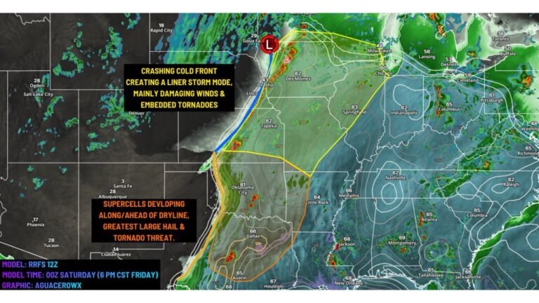
TEXAS AND OKLAHOMA — The Storm Prediction Center has introduced a Day 6 severe weather risk for Wednesday, March 4, outlining a 15% probability area across North Texas into southern and central Oklahoma as a more active early-March pattern begins to take shape.
While this threat is centered well west of North Carolina, the evolving setup signals a broader national shift toward increased storm activity during the first half of March.
SPC Introduces 15% Risk Zone for March 4
The highlighted severe weather area includes portions of:
North Texas, including areas near and north of Dallas–Fort Worth
Southern and central Oklahoma, extending toward the Red River region
A 15% risk area at Day 6 is notable. At this extended range, it suggests growing confidence that environmental conditions may support organized severe thunderstorms.
Though exact storm placement and intensity remain uncertain, the introduction of this outlook this early underscores the potential for a meaningful event.
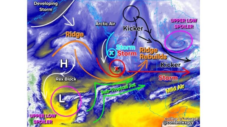
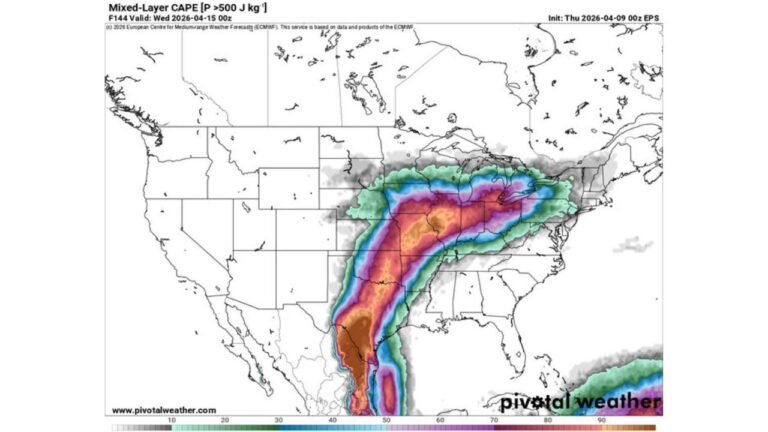
Pattern Turning More Active
Long-range ensemble guidance has been signaling a shift toward a more amplified and energetic upper-level pattern, supporting repeated storm systems tracking across the southern Plains.
The March 4 setup appears to be the first in what could become a series of storm opportunities during the March 6–10 timeframe.
Forecast discussions point to:
Strengthening upper-level disturbances moving out of the western U.S.
Increasing Gulf moisture return northward into Texas and Oklahoma
A developing warm sector supportive of stronger thunderstorms
This combination is often associated with early spring severe weather across the southern Plains.
What Hazards Could Be Possible?
Specific hazards remain unclear at this distance. However, in similar early-season setups across North Texas and Oklahoma, the primary risks can include:
Damaging straight-line winds
Large hail
Isolated tornado potential, especially if discrete storms develop ahead of any frontal boundary
Storm mode — whether storms organize into supercells or form into a line — will play a major role in determining the dominant threat.
Forecast clarity will improve as higher-resolution models begin resolving finer-scale details early next week.
March 6–10: Additional Severe Signals Emerging
Beyond March 4, ensemble data suggests a potentially active severe weather window between March 6 and March 10.
While no specific risk areas have been defined for those dates yet, forecasters are watching signals of:
Continued upper-level troughing
Persistent moisture feed from the Gulf
Repeated storm system passages
If the pattern verifies, multiple severe weather episodes could unfold across portions of the southern and central United States.
What This Means for North Carolina
Although the current severe weather focus is on Texas and Oklahoma, broader atmospheric shifts often progress eastward with time.
An increasingly active pattern across the southern Plains can eventually translate into:
Higher rain and thunderstorm chances across the Southeast
Greater variability in temperatures
Potential for stronger storm systems moving toward the Carolinas later in the month
Residents in Cabarrus County should continue monitoring forecast updates as the national pattern evolves.
If you have travel plans to Texas or Oklahoma around March 4, stay weather aware and keep an eye on updated outlooks as we move closer to the event. For continued regional weather coverage and updates affecting North Carolina, follow CabarrusWeekly.com.