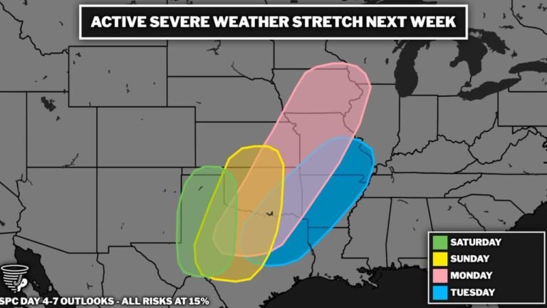
While All Eyes Are on Wisconsin, Oklahoma Is Getting Slammed Too: Golf Ball to Baseball-Sized Hail Up to 2-3 Inches Looking Increasingly Likely From Vernon Texas Through Oklahoma City and Up I-44 to the Kansas Border by 3-5 PM Today
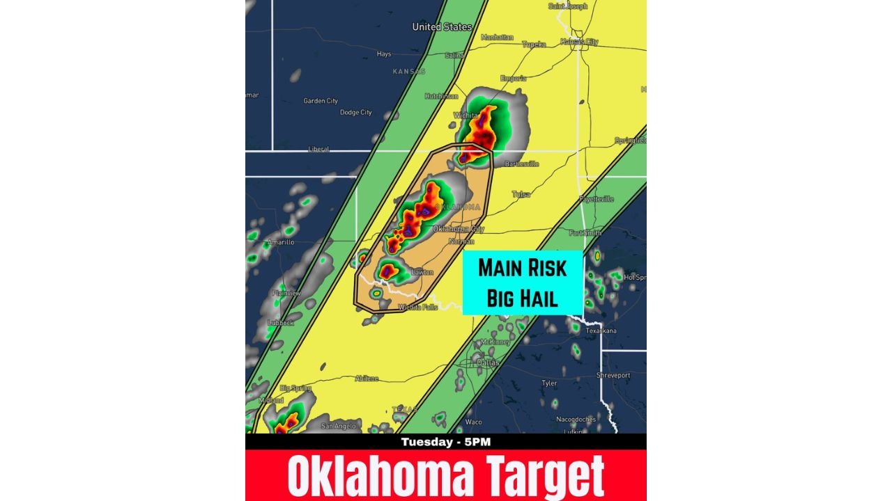
OKLAHOMA — While the national spotlight is fixed on the tornado outbreak unfolding across southern Wisconsin today, Oklahoma is quietly setting up for one of the most significant hail events of the season — and it is happening this afternoon. 2 to 3 inch hail is looking more and more likely along a corridor stretching from the Vernon, Texas area north through Oklahoma City, Norman, Lawton, and Bartlesville up Interstate 44 all the way to the Kansas border. A cluster of storms is expected to form between 3 and 5 PM — and the main risk is simply labeled: Big Hail.
The Oklahoma Target — 3 to 5 PM Tuesday
The severe weather setup in Oklahoma today is being specifically identified as the Oklahoma Target for Tuesday afternoon. While it shares the day with the Wisconsin tornado outbreak, this is an independent and dangerous severe weather event in its own right — centered on a defined corridor running north-south through the heart of Oklahoma and into the Texas Panhandle border region.
A cluster of storms is forecast to form along this corridor between 3 and 5 PM local time, and the environment is described as increasingly favorable for very large hail production from the strongest cells.
The Hail Corridor — Vernon Texas to the Kansas Border
The primary hail threat zone is a defined oval stretching from the Vernon, Texas area in the south northward through Oklahoma along Interstate 44 to the Kansas border. This corridor encompasses some of the most storm-prone real estate in the country and today it is squarely in the crosshairs for destructive hail.
| Area | Hail Threat Status |
|---|---|
| Vernon, Texas area | Southern anchor of the 2-3 inch hail corridor |
| Wichita Falls, Texas | Inside primary hail risk zone |
| Lawton, Oklahoma | Inside primary hail risk zone |
| Oklahoma City, Oklahoma | Inside primary hail risk zone — core threat area |
| Norman, Oklahoma | Inside primary hail risk zone |
| Bartlesville, Oklahoma | Inside primary hail risk zone — northern portion |
| Wichita, Kansas | Near northern edge — Kansas border zone |
| Tulsa, Oklahoma | Near eastern edge of primary zone |
| Emporia, Kansas | Outer surrounding zone |
| Dodge City, Kansas | Western outer zone |
| Garden City, Kansas | Western outer zone |
The core of the hail threat runs directly through Oklahoma City, Norman, Lawton, and Bartlesville — the densest population corridor within the primary risk zone — before extending north toward the Kansas border near Wichita.
2 to 3 Inch Hail — What That Actually Means
The 2 to 3 inch hail being specifically called out for today’s Oklahoma corridor represents some of the most destructive hail sizes that thunderstorm updrafts can produce. Understanding what those sizes mean on the ground is critical for anyone in the threat zone.
| Hail Size | Approximate Diameter | Real-World Comparison | Damage |
|---|---|---|---|
| 1.75 inches | Golf ball | Golf ball | Shatters vehicle glass, significant roof damage |
| 2.00 inches | Hen egg | Hen egg | Destroys vehicle glass entirely, punches through roofing |
| 2.50 inches | Baseball | Baseball | Catastrophic vehicle damage, roof punctures, life-threatening outdoors |
| 3.00 inches | Tea cup | Tea cup | Extreme structural damage, total vehicle destruction |
2 to 3 inch hail is at the extreme upper end of what most people will ever experience. A single stone of 3-inch hail falling at terminal velocity is capable of penetrating a vehicle roof, punching through residential roofing materials, and causing fatal injury to anyone caught in the open. This is not the kind of hail event where you step outside to watch the sky.
The Main Risk Is Big Hail — But the Setup Carries More
The outlook map labels the primary risk for today’s Oklahoma corridor clearly: Main Risk — Big Hail. The hail threat is the headliner for this specific event. However, the broader severe weather environment across Oklahoma today — sitting within the Slight Risk zone on the categorical outlook — also carries the potential for:
- Damaging winds from the strongest storm cells within the cluster
- Isolated tornado potential as part of the broader southern Plains severe weather setup later in the evening as the low-level jet intensifies
But the defining and most certain hazard today for the Vernon to Oklahoma City to Kansas border corridor is the 2 to 3 inch hail from storms firing between 3 and 5 PM.
Risk Zones Surrounding the Oklahoma Core
| Risk Zone | Areas |
|---|---|
| Core hail risk — primary oval | Vernon TX, Wichita Falls, Lawton, Oklahoma City, Norman, Bartlesville to Kansas border |
| Slight Risk — yellow zone | Broader Oklahoma, southern Kansas including Wichita, Emporia, Topeka, Manhattan, Kansas City edge |
| Marginal Risk — green zone | Texas Panhandle, Amarillo edge, Dallas corridor, eastern Oklahoma, Fayetteville AR |
What Oklahoma Residents Must Do Before 3 PM
The storm cluster forms between 3 and 5 PM. The window to protect vehicles, property, and people is right now — this morning and early afternoon.
- Get every vehicle under cover before 3 PM — a garage, carport, or any solid overhead structure. 2 to 3 inch hail will total an unprotected vehicle — shatter every window, dent every body panel, and destroy the roof — in a matter of seconds. There is no recovering a car from a direct hit by 3-inch hailstones.
- Do not go outdoors when hail begins falling — hail of this size falls at speeds that can cause serious injury and is lethal to anyone caught in the open without overhead protection
- Bring in all outdoor furniture, equipment, and pets before 3 PM — 3-inch hailstones will destroy outdoor furniture and cause fatal injuries to animals left outside
- Stay away from windows during the hailstorm — 2 to 3 inch hail can shatter residential windows and send glass and debris into interior spaces
- If caught driving when hail begins — pull under an overpass or into a covered parking structure immediately and do not continue driving. Windshields cannot withstand 2 to 3 inch hail and visibility drops to zero almost instantly when large hail begins
Tuesday Oklahoma Hail Threat at a Glance
| Factor | Details |
|---|---|
| Primary threat area | Vernon TX north through Oklahoma City, Norman, Lawton, Bartlesville to Kansas border |
| Storm initiation time | 3 to 5 PM Tuesday |
| Maximum hail size | 2 to 3 inches — golf ball to baseball and larger |
| Main labeled risk | Big Hail |
| Corridor | Along Interstate 44 from Vernon TX to Kansas border |
| Surrounding risk zone | Broader Oklahoma, southern Kansas, Wichita corridor |
| Action deadline | Before 3 PM — vehicles and property must be protected |
Oklahoma Is a Target Today — And the Hail Threat Is Real and Imminent
While Wisconsin dominates today’s severe weather headlines with its tornado outbreak, Oklahoma is running its own dangerous severe weather event simultaneously — and the 2 to 3 inch hail threat along the Vernon Texas to Oklahoma City to Kansas border corridor is one of the most significant hail setups the state has seen this season.
Storms fire at 3 to 5 PM. The hail will be 2 to 3 inches. The corridor runs through Oklahoma City, Norman, Lawton, Bartlesville, and Wichita Falls. Every vehicle, every property, and every person in that zone needs to be protected before the afternoon arrives.
Stay with CabarrusWeekly.com for live Tuesday severe weather coverage across Oklahoma, hail reports as storms develop along the I-44 corridor, and real-time updates on the 3 to 5 PM storm cluster targeting the Oklahoma City and surrounding region this afternoon.