Oklahoma and Missouri Face Returning Severe Weather Friday With Damaging Winds, Large Hail, and Tornado Threat on May 8
OKLAHOMA AND MISSOURI — Severe weather is returning to Oklahoma and Missouri on Friday, May 8, 2026, with isolated damaging winds, large hail, and a brief tornado all possible across the risk zone. The categorical outlook issued May 7, 2026 at 3:51 AM ET places a Marginal Risk across a broad corridor covering both states.
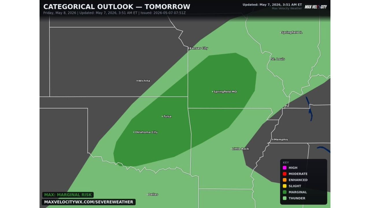
The Risk Zone for Friday May 8
The Marginal Risk area covers a wide swath stretching from Oklahoma City and Tulsa northward through Springfield, Missouri and toward Kansas City. A tighter inner zone of deeper Marginal Risk sits centered over central Missouri and northeastern Oklahoma, where the threat is most concentrated.
Cities within the risk area include:
- Oklahoma City, Oklahoma
- Tulsa, Oklahoma
- Springfield, Missouri
- Kansas City, Missouri
- St. Louis, Missouri
- Little Rock, Arkansas
Hazards Expected Friday
Residents across the risk zone should be aware of the following threats on Friday:
- Isolated damaging winds
- Large hail
- Brief tornado possible
How Serious Is This Event
Forecasters describe Friday as a low-end severe weather day for Oklahoma and Missouri. The maximum risk level on the categorical outlook is Marginal, the lowest tier of the severe weather risk scale, indicating that widespread or intense severe weather is not expected. Events will be isolated in nature.
What Residents Should Do
While this is a low-end event, isolated severe storms can still produce dangerous conditions locally. Residents across Oklahoma City, Tulsa, Springfield, and Kansas City should monitor local forecasts through the day Friday and remain weather aware, particularly during afternoon and evening hours when storm activity is most likely.
Stay with CabarrusWeekly.com for continuing updates on the Friday severe weather threat across Oklahoma and Missouri.