South Central Kansas Including Wichita, Hutchinson and Newton Under Special Weather Statement for Funnel Clouds and Landspouts This Afternoon
SOUTH CENTRAL KANSAS — The National Weather Service in Wichita has issued a Special Weather Statement at 2:24 PM CDT on Thursday, May 28, 2026, warning that conditions are becoming increasingly favorable for funnel clouds and possible landspouts across south-central Kansas this afternoon. A few cold air funnels are also possible extending into extreme northern Oklahoma this evening.
What NWS Wichita Is Saying
The Special Weather Statement is direct: conditions are trending toward funnel cloud development across the affected counties. Key points from the official statement:
- Funnel clouds are possible across south-central Kansas this afternoon
- A landspout or two cannot be ruled out
- Any funnel cloud that touches the ground will be very brief and weak
- Potential impacts are expected to remain low
- Showers may also produce lightning, brief heavy rainfall and gusty winds
Counties Under the Statement
The Special Weather Statement covers the following Kansas counties:
- Reno, Butler, Harper, Cowley, Harvey
- Sumner, Sedgwick, Kingman
Cities and Communities Directly Impacted
The NWS has specifically identified the following locations as impacted:
Wichita, Hutchinson, Derby, Newton, El Dorado, Arkansas City, Winfield, Andover, Haysville, Augusta, Wellington, Park City, Valley Center, Bel Aire, Mulvane, Goddard, Rose Hill, Hesston, Maize and Kingman.
Highway Corridors in the Zone
Two major Interstate corridors fall within the affected area:
- Interstate 135 between Mile Markers 0 and 43
- Interstate 35 between Mile Markers 1 and 96
Drivers traveling these routes this afternoon should remain alert for rapidly changing weather conditions and reduced visibility if heavy showers develop near the roadway.
Why Funnels Are Forming
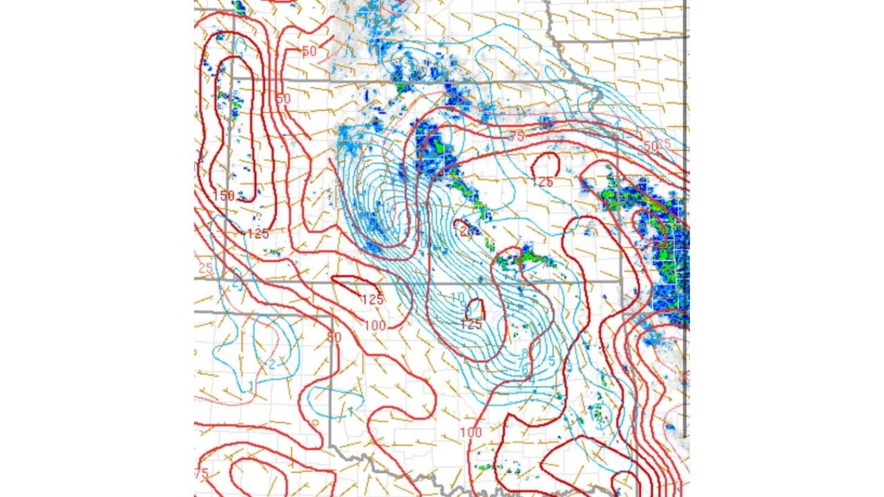
The vorticity plot shown in the forecast graphic displays concentrated spin values in blue across south-central Kansas, with weak showers and storms already firing along the vorticity axis. When these storms encounter pockets of enhanced spin at the surface, updrafts can vertically stretch that spin into brief, weak funnel clouds. This is a cold air funnel setup, not a supercell tornado environment, meaning organized tornado development is not expected.
What Residents Should Do
- Seek shelter immediately if lightning is heard or thunder observed
- Do not attempt to observe funnel clouds from exposed outdoor locations
- Monitor local NWS updates as conditions evolve through the afternoon and evening
- Drivers on I-135 and I-35 should watch for sudden heavy rain and gusty winds
Stay with CabarrusWeekly.com for continuing updates as this funnel cloud threat is monitored across south-central Kansas through Thursday evening.