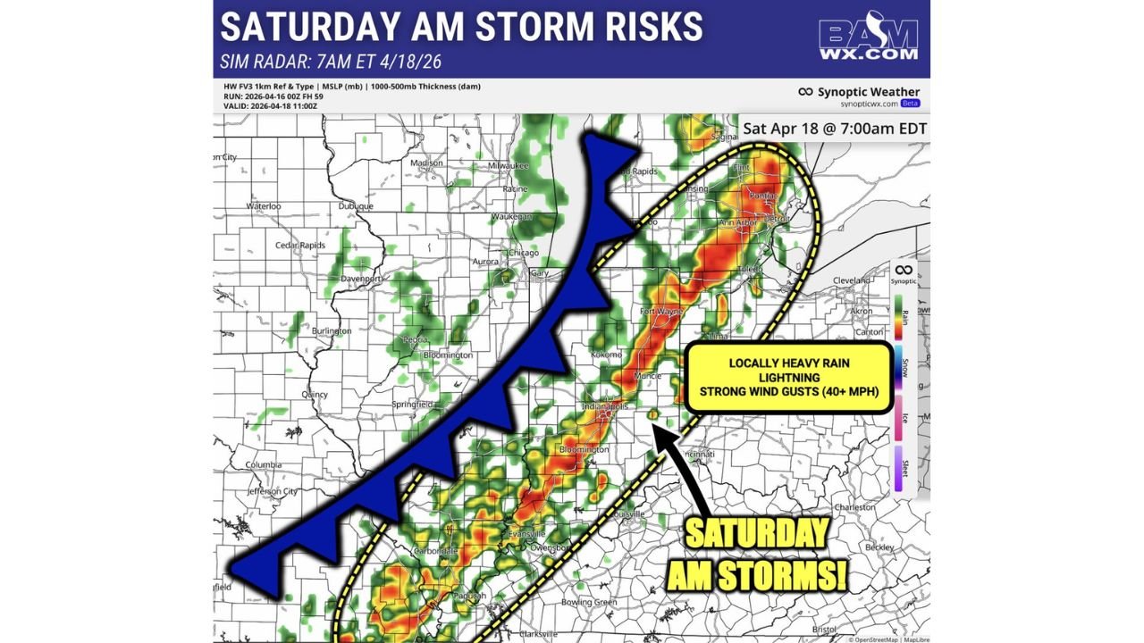
Strong Storms With 40 to 50 MPH Wind Gusts and Heavy Rain Move Through Michigan, Indiana, and Kentucky Saturday Morning
MICHIGAN, INDIANA, AND KENTUCKY — A line of storms is moving through the Great Lakes and Ohio Valley region Saturday morning April 18, 2026, bringing locally heavy rain, frequent lightning, and strong wind gusts of 40 to 50 mph to a corridor stretching from Detroit and Ann Arbor south through Fort Wayne, Indianapolis, Kokomo, Evansville, Louisville, and Owensboro. Forecast radar valid at 7:00 AM EDT shows the most intense activity concentrated across this zone.
Where the Heaviest Activity Is Focused
The primary storm corridor Saturday morning runs along and ahead of a cold front pushing southeast. The most intense radar returns are concentrated across:
| Area | Hazards |
|---|---|
| Detroit, Ann Arbor, Pontiac, Toledo | Locally heavy rain, lightning, 40 mph gusts |
| Fort Wayne, Kokomo, Muncie | Heavy rain, strong wind gusts, lightning |
| Indianapolis, Bloomington | Heavy rain, 40 to 50 mph gusts |
| Evansville, Owensboro, Louisville | Heavy rain, lightning, gusty winds |
| Carbondale, Paducah, Clarksville | Southern edge of storm corridor |
What to Expect Saturday Morning
A few strong storms within this line are capable of producing wind gusts exceeding 40 to 50 mph — strong enough to down tree branches and cause brief power outages across the affected corridor. Locally heavy rain will reduce visibility on roads and cause standing water in low-lying areas. Lightning will be frequent within the most active cells.
This is not a tornado outbreak — but 50 mph wind gusts during a morning commute are dangerous on the road and damaging to unsecured outdoor property.
Have alerts active, drive carefully through storm-affected areas, and expect possible brief power outages Saturday morning across Michigan, Indiana, and Kentucky.
Stay with CabarrusWeekly.com for live Saturday storm updates across the Great Lakes and Ohio Valley.