West Texas and Eastern New Mexico Kick Off Multi-Day Severe Weather Pattern Saturday With Supercells, Large Hail and Evening Storm Complex Risk
TEXAS, NEW MEXICO — The start of a multi-day severe weather pattern is expected Saturday, with the first round of storms developing across the Southern Plains, particularly in west Texas and eastern New Mexico.
Level 2 Risk Targets West Texas and Eastern New Mexico
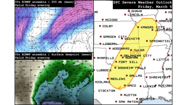
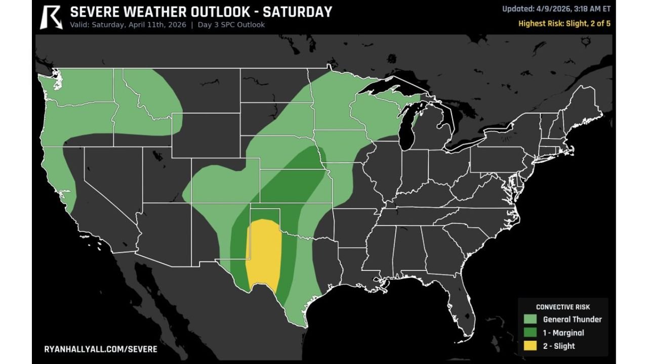
The Storm Prediction Center has outlined a Slight Risk (Level 2 of 5) centered over west Texas and extending into eastern New Mexico, marking the most active zone for severe storms on Saturday.
Surrounding areas across the Plains remain under broader thunderstorm risk zones, but the highest potential for organized severe weather will be concentrated in this region.
Supercells Likely With Large Hail and Damaging Winds
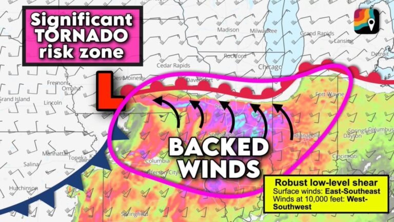
As atmospheric instability builds through the day, conditions will support the development of supercell thunderstorms by the afternoon.
These storms will be capable of producing large hail and damaging wind gusts, especially where storms remain isolated and intensify quickly.
Steep lapse rates across the region will further enhance the risk for strong updrafts, increasing the likelihood of significant hail production.
Organized Storm Complex May Develop by Evening
As the day progresses into the evening hours, storms may begin to organize into a larger storm complex across west-central Texas.
This transition from isolated storms to a more organized system could lead to broader areas of strong winds and heavy rainfall, expanding the impact beyond initial storm development zones.
Expanding Storm Coverage Across the Plains
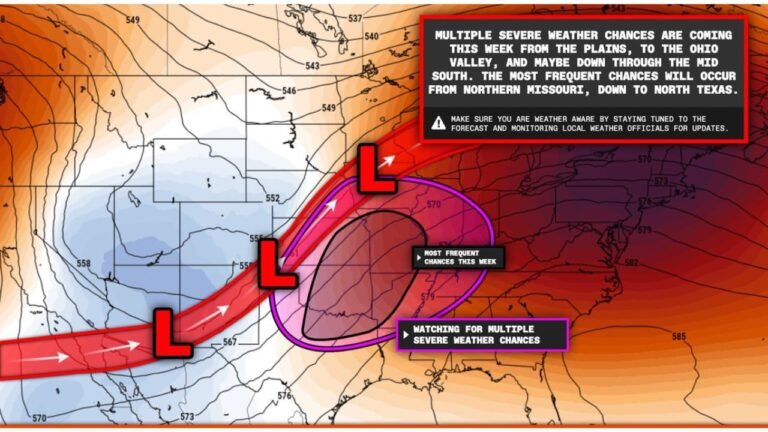
While the highest risk is focused over west Texas and eastern New Mexico, a wider area of general thunderstorms and marginal severe risk extends across parts of the central and northern Plains.
This indicates a growing and evolving system that will continue to develop and shift in the coming days.
Beginning of a Larger Severe Weather Sequence
Saturday’s storms represent the opening phase of a longer multi-day severe weather pattern, which is expected to expand and intensify across the central United States into early next week.
This initial setup lays the groundwork for more widespread and potentially stronger severe weather events in the days ahead.
Timing and What to Watch
Storm development is expected to begin during the afternoon hours, with activity continuing into the evening as storms organize.
Residents across west Texas and eastern New Mexico should stay alert for rapidly changing weather conditions, especially with the potential for large hail and damaging winds developing quickly.
Stay with CabarrusWeekly.com for continued updates as this multi-day severe weather pattern begins, and share what conditions you are seeing in your area.