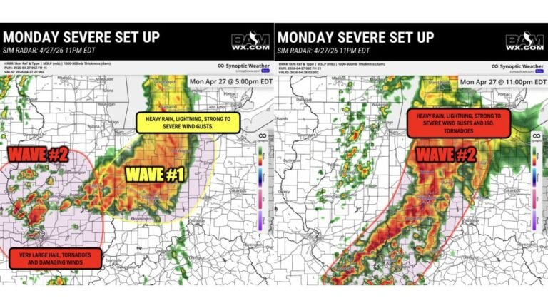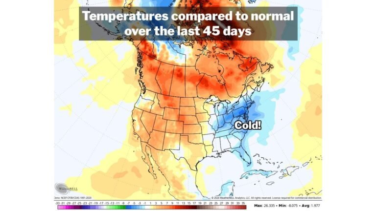
Another Dangerous Severe Weather Sequence Targets the Southern US April 25 to 28 With Supercell Potential SurgingSOUTHERN UNITED STATES — A powerful and potentially dangerous multi-day severe weather sequence is building for late April, with atmospheric data valid through April 25 to 28, 2026 showing a convergence of ingredients across the Southern United States that could support widespread severe thunderstorms, supercells, and significant tornado potential across a corridor stretching from the Southern Plains through the Deep South.
SOUTHERN UNITED STATES — A powerful and potentially dangerous multi-day severe weather sequence is building for late April, with atmospheric data valid through April 25 to 28, 2026 showing a convergence of ingredients across the Southern United States that could support widespread severe thunderstorms, supercells, and significant tornado potential across a corridor stretching from the Southern Plains through the Deep South.
Severe Weather Analog Data Flags 50 to 80 Percent Probability Across the South
Six to eight day severe weather analog data valid April 25 through April 28 shows a sweeping and intense probability footprint across the central and southern United States. The highest analog probabilities — reaching 70 to 80 percent — are concentrated across Oklahoma, Kansas, Arkansas, Missouri, and Tennessee, indicating that historical atmospheric analogs strongly support a significant severe weather outbreak during this window.
A broader zone of 40 to 60 percent probability extends across Texas, Louisiana, Mississippi, Alabama, and Kentucky, placing the entire Deep South region under elevated concern heading into the final week of April.
Powerful Jet Stream and Strong Wind Fields in Place by April 28
Upper-level atmospheric data valid April 28 shows a strong and fast-moving jet stream driving across the Southern United States from west to east, with wind speeds in the 115 to 140 knot range across the core of the flow. This type of powerful upper-level support is a critical ingredient for organizing severe thunderstorm complexes and supporting long-track tornado-producing supercells across the region.
The 500mb pattern shows a classic late-April severe weather configuration with deep troughing across the West and a sharp ridge-trough interface positioned directly over the Southern Plains and Mid-South.
Gulf Moisture Surges Deep Into the South by Late April
Dew point data valid April 28 shows rich Gulf of Mexico moisture streaming deep into the Southern United States, with surface dew points reaching 65 to 75°F across coastal Texas, Louisiana, Mississippi, and Alabama. This exceptionally moist and unstable air mass surging northward ahead of the approaching trough will provide the fuel needed to power intense thunderstorm development across the region.
Median dew point values across Arkansas, Tennessee, and Mississippi are forecast in the 55 to 65°F range — more than sufficient to support explosive storm development when combined with the strong upper-level wind fields in place.
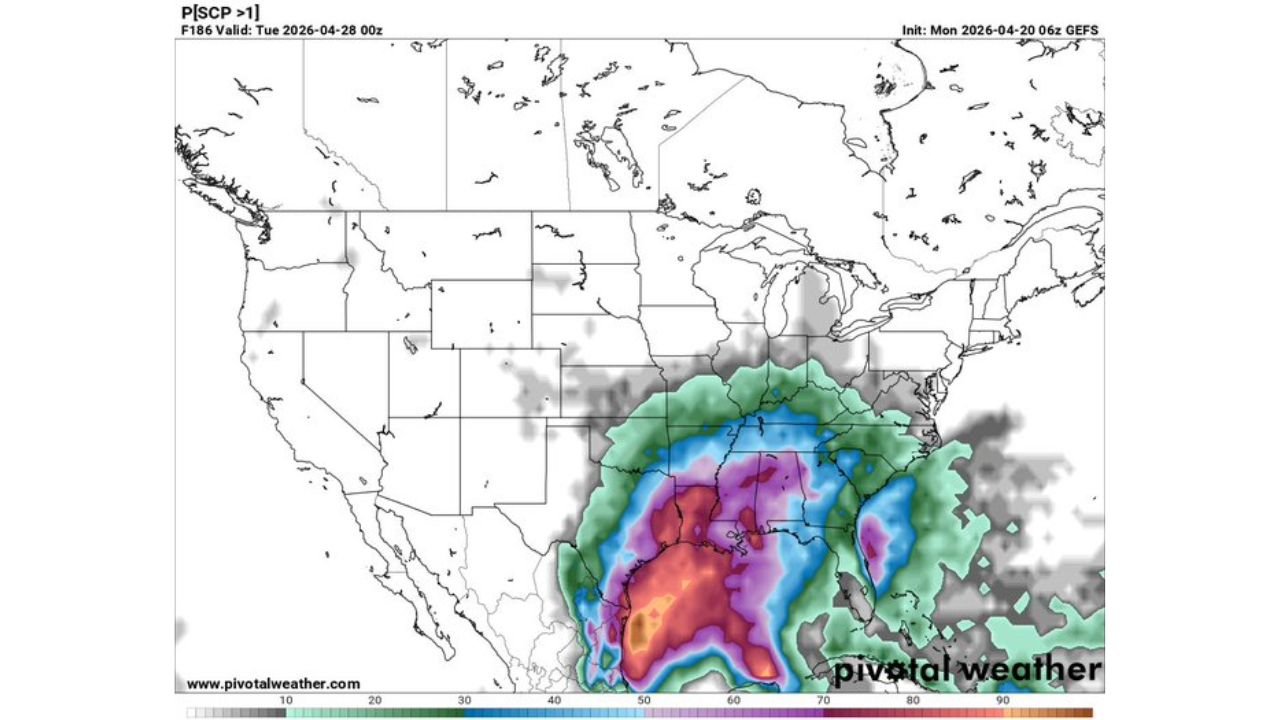
Supercell Composite Parameter Explodes Across the Deep South
Supercell Composite Parameter probability data valid April 28 delivers perhaps the most striking signal in this dataset. The probability of SCP exceeding 1 — a threshold indicating a supercell-favorable environment — reaches 70 to over 90 percent across a massive zone covering Louisiana, Mississippi, Alabama, Arkansas, and Tennessee, with elevated probabilities extending into Texas, Georgia, and the western Carolinas.
This level of supercell parameter probability at more than a week’s range is an exceptionally rare and serious signal, suggesting the late April pattern could support organized, long-track supercells capable of significant tornadoes, very large hail, and destructive winds across the Deep South.
| Data Type | Peak Value | Highest Risk Zone |
|---|---|---|
| Severe Weather Analog Probability | 70 to 80% | Oklahoma, Arkansas, Tennessee |
| Upper Jet Stream Winds | 115 to 140 knots | Southern US corridor |
| Surface Dew Points | 65 to 75°F | Gulf Coast states |
| Supercell Composite Probability | 70 to 90%+ | Louisiana, Mississippi, Alabama |
Specific Days and Details Still Evolving
Given the 8 to 10 day forecast range, exact timing, location, and intensity of individual storm events within this window remain subject to change. Model variability is still elevated at this range, and specific day-by-day breakdowns will become clearer later this week as the pattern comes into sharper focus. What is already clear, however, is that late April carries the potential for a significant and dangerous severe weather outbreak across the Southern United States.
Residents across Oklahoma, Arkansas, Louisiana, Mississippi, Alabama, and Tennessee should begin monitoring forecasts closely and ensure severe weather plans and shelter locations are identified well in advance.
Stay with CabarrusWeekly.com for continuing late April severe weather outlook updates across the Southern United States.