Florida Faces Mid-Summer Pattern With 6 to 10 Plus Inches of Rain Through June 8 as Tropical Humidity Surge Brings Daily Downpours and Localized Flood Potential Statewide
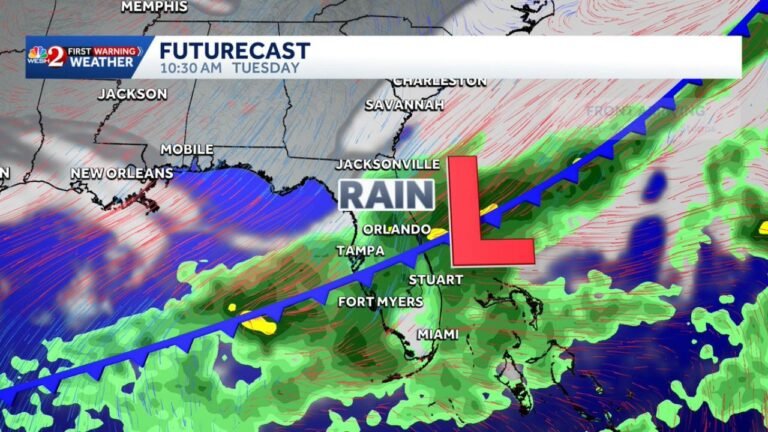
FLORIDA — A major pattern change is arriving for Florida late this week, bringing a surge of tropical humidity not seen since last summer and delivering what will feel like July and August weather to open June. Both the GFS and Euro models are in agreement on a very beneficial but potentially flood-producing start to June, with daily afternoon downpours and storms through roughly June 8 and rain totals ranging from 6 to 10 plus inches across much of the state.
What the Two Models Are Showing Through June 8
Both major global models are painting a dramatically wet picture for Florida through the first week of June, with some differences in where the heaviest totals land.
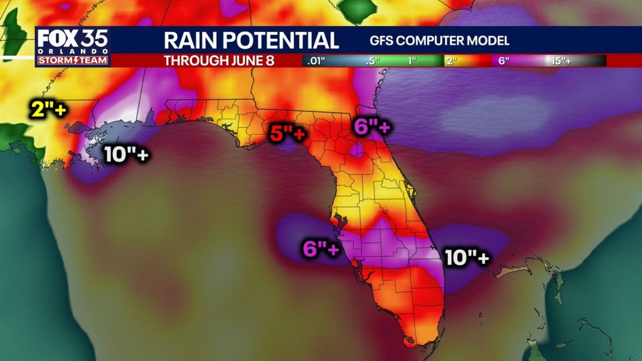
GFS model rain potential through June 8:
| Region | GFS Forecast Total |
|---|---|
| Gulf Coast / New Orleans corridor west | 10 inches or more |
| Florida Panhandle | 5 inches or more |
| Northeast Florida | 6 inches or more |
| Central Florida | 2 to 6 inches |
| Southwest Florida offshore zone | 6 inches or more |
| Atlantic Coast offshore | 10 inches or more |
Euro model rain potential through June 8:
| Region | Euro Forecast Total |
|---|---|
| Gulf Coast west of Florida | 10 inches or more |
| Florida Panhandle into North Florida | 6 inches or more |
| Central Florida | 5 to 6 inches |
| South Florida | 2 to 5 inches |
| Atlantic offshore zone | 6 inches or more |
Where the Two Models Agree and Disagree
Points of agreement between GFS and Euro:
- Both show 6 inches or more across the Florida Panhandle and North Florida
- Both show 10 plus inches across the Gulf Coast zone west of Florida
- Both confirm a beneficial and significant rainfall event statewide through June 8
- Both support daily afternoon storm activity as the dominant weather pattern
Key differences:
- GFS is more aggressive with totals across South Florida and offshore zones
- Euro keeps South Florida drier with totals closer to 2 to 5 inches
- The location of the highest totals within Florida remains the most uncertain element of the forecast
- Both agree the pattern is wet — the disagreement is about exactly where the peak rainfall focuses
What the Tropical Humidity Surge Means for Daily Life
The incoming moisture surge is not a single storm event. It is a sustained pattern shift that will lock Florida into a mid-summer-like regime for approximately two weeks.
What to expect daily through June 8:
- Morning hours generally starting partly cloudy to partly sunny
- Afternoon heating rapidly building clouds and triggering downpours by early to mid afternoon
- Daily PM storms will vary in coverage and intensity from day to day
- Some days will see widespread storms, others more isolated
- Humidity levels highest since last summer making heat index values feel oppressive
- Localized flooding possible on any given day depending on where training storms develop
Tropical Development in the Gulf Remains a Low Confidence Factor
Guidance is hinting at possible weak tropical development in the Gulf of Mexico next week, which could add a corridor of notably higher rainfall somewhere across the state if it were to materialize.
Tropical development assessment:
| Factor | Status |
|---|---|
| Weak tropical development in Gulf | Low probability next week |
| Confidence in development | Low, not buying it heavily at this time |
| Impact if development occurs | Could add focused corridor of heavier rain |
| Primary concern right now | Needed rains and localized flood potential |
| Tropical storm or hurricane threat | Not a current concern |
The primary story remains rainfall and drought relief, not tropical development. Even without any tropical system forming, the moisture surge alone will deliver significant statewide totals through the first week of June.
Florida Drought Relief Context
Florida has been dealing with its worst drought in over 25 years, making this incoming moisture surge one of the most impactful weather events of the year for the state’s water resources. The pattern arriving this week represents the most significant drought relief opportunity Florida has seen in many months.
Drought relief versus flood risk balance:
- 6 to 10 plus inches needed across much of the state to make meaningful drought recovery progress
- Daily storms spread over 10 to 14 days allow better soil absorption than a single extreme event
- Localized flood potential remains real even during a drought as intense afternoon downpours overwhelm drainage quickly
- Turn around, do not drown applies throughout this entire pattern regardless of drought conditions
- Water managers and reservoir operators will be actively monitoring inflows throughout the period
Stay with CabarrusWeekly.com for continuing updates on Florida’s incoming tropical moisture surge and the daily storm forecast through June 8.