Florida Faces Weekend Afternoon and Evening Storms With 2 to 3 Inches Possible Near Tampa, Orlando and North Port as Sunday Brings Greater Coverage Across the Western Peninsula May 16-17
TAMPA, FLORIDA — Storm chances are in place across Florida this weekend, with the best opportunity for showers and storms during the afternoon and evening hours both Saturday and Sunday May 16 and 17, 2026. Sunday brings significantly greater storm coverage than Saturday, with heavier cells capable of dropping 2 to 3 inches or more of rain in a short time if they park over any one location — a taste of what the upcoming rainy season will feel like.
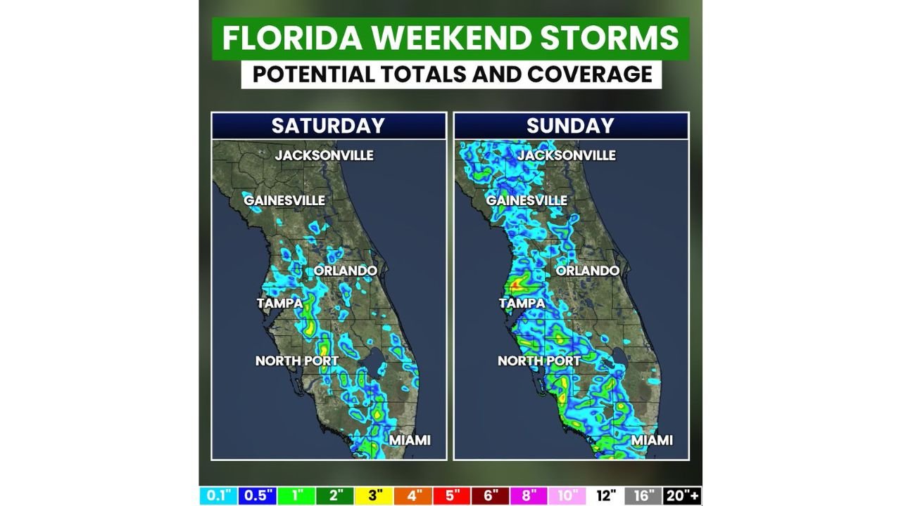
Saturday vs Sunday Storm Coverage
Saturday May 16: Storm coverage is scattered and limited, with activity concentrated mainly along the west coast corridor from Tampa and North Port southward toward Miami. Jacksonville, Gainesville, and Orlando see very little activity Saturday. Not everyone will see rain.
Sunday May 17: Coverage expands dramatically, with storms spreading across much of the Florida Peninsula from Jacksonville and Gainesville in the north through Orlando, Tampa, and North Port down to Miami. The western side of the peninsula sees notably more activity Sunday than Saturday, with the heaviest cells capable of localized totals of 2 to 3 inches or greater.
Localized Heavy Rain Threat Sunday
While not everyone will see rain, any heavier cell that stalls or parks over a neighborhood could produce quick 2 to 3 inch rainfall totals in a short period. Flash flooding cannot be ruled out in those isolated spots.
Make Plans Early Both Days
With the best storm window arriving during the afternoon and evening hours, outdoor plans across the Florida Peninsula should be made for the morning hours this weekend to avoid the peak storm timing.
Stay with CabarrusWeekly.com for the latest updates as these Florida weekend storms develop through Saturday and Sunday.