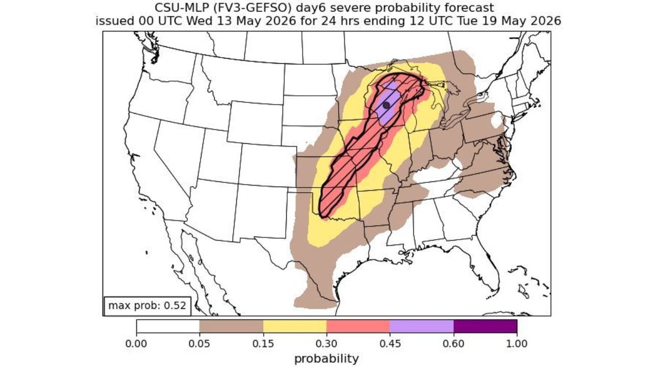
Kansas, Iowa, Illinois, Indiana and Michigan Face a Very Large Hatched Severe Weather Risk With All Hazards Possible and 52% Maximum Probability Across the Central US Monday May 18
KANSAS — A very large hatched severe weather risk has been issued for the Central United States on Monday May 18, 2026, with all hazards of severe weather possible across a massive corridor. A Day 6 severe probability forecast issued at 00 UTC Wednesday May 13, 2026 valid for 24 hours ending 12 UTC Tuesday May 19 shows a maximum probability of 52% centered over the core threat zone.
Threat Zone Breakdown
The probability map shows a well-defined and expanding risk corridor across the central and eastern United States:
- Core hatched zone — 45% or greater probability — centered over Iowa, Illinois, Indiana, and into Michigan — the highest risk area for Monday
- 30% probability zone — covering Kansas, Missouri, Kentucky, and Ohio
- 15% probability zone — broad yellow area stretching from the Southern Plains through the Great Lakes and into the Mid-Atlantic
- Outer fringe zone — extends across nearly the entire eastern half of the United States
All Hazards on the Table
The outlook specifically flags all hazards of severe weather as possible for Monday, meaning:
- Tornadoes
- Very large hail
- Damaging winds
One of the Larger Day 6 Severe Setups of the Season
A maximum probability of 52% on a Day 6 forecast is a significant signal. The hatched zone covering Iowa, Illinois, Indiana, and Michigan represents a potentially high-impact severe weather event that warrants close monitoring through the rest of the week.
Stay with CabarrusWeekly.com for daily updates as this major Monday severe weather threat continues to develop.